Research Assistants / PhD students
Mag. Christopher Sevara
Research Topic : ![]() In Visible Landscapes : Development of Novel Integrated Techniques for Remnant Historic Land Use Detection and Characterisation.
In Visible Landscapes : Development of Novel Integrated Techniques for Remnant Historic Land Use Detection and Characterisation.
Christopher Sevara has been working in contract and research-based archaeology since the mid 1990's, specializing in digital field data collection, data management, the use of GIS, surveying and cartography. Additionally, he has held lectures and courses in digital field data collection and taught at field schools in Sweden and southern Italy. He has worked as a specialist on a number of multinational archaeological projects, helping to design rapid data collection strategies and integrate geospatially-oriented electronic data capture processes into archaeological workflows. He received two Master's degrees from the ![]() University of Gothenburg, in Archaeology and Archaeological Computing, where his project topics focused on landscape modeling using satellite stereo pair imagery and the creation of bespoke, context-based systems for digital recording of archaeological information on mobile devices. His current research interests include issues dealing with the creation of GIS-based multitemporal landscape visualizations using hybrid remote sensing data, image-based modeling, development and distribution of interactive archaeological geocontent via custom web and mobile platforms, and designing novel, integrated approaches for historic landscape classification and management. He has participated in numerous projects in the American Southwest, Bosnia & Herzegovina,
University of Gothenburg, in Archaeology and Archaeological Computing, where his project topics focused on landscape modeling using satellite stereo pair imagery and the creation of bespoke, context-based systems for digital recording of archaeological information on mobile devices. His current research interests include issues dealing with the creation of GIS-based multitemporal landscape visualizations using hybrid remote sensing data, image-based modeling, development and distribution of interactive archaeological geocontent via custom web and mobile platforms, and designing novel, integrated approaches for historic landscape classification and management. He has participated in numerous projects in the American Southwest, Bosnia & Herzegovina, ![]() Italy, Sweden,
Italy, Sweden, ![]() Sudan, and Tunisia.
Sudan, and Tunisia.
Mag. Jakob Kainz, MSc.
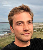
Jakob Kainz studied archaeology, geophysics and history in the United Kingdom. He completed his BA in Archaeology and History at the ![]() University of Southampton from 2000-2003. In 2006 he attended Orkney College at the
University of Southampton from 2000-2003. In 2006 he attended Orkney College at the ![]() University of the Highlands and Islands, Scotland for an MA in Archaeological Practice. From 2006 he has worked on archaeological commercial and research projects in the Northern Isles of Scotland for
University of the Highlands and Islands, Scotland for an MA in Archaeological Practice. From 2006 he has worked on archaeological commercial and research projects in the Northern Isles of Scotland for ![]() ORCA and EASE Archaeology; these included the
ORCA and EASE Archaeology; these included the ![]() Ness of Brodgar and the
Ness of Brodgar and the ![]() Links of Noltland. During 2007-2010 he worked for
Links of Noltland. During 2007-2010 he worked for ![]() OCGU on geophysical surveys at the World Heritage Area in Orkney. This started his interest in geophysical prospection for archaeology and led to an MSc in Shallow Geophysics for Archaeologists and Environmentalists at
OCGU on geophysical surveys at the World Heritage Area in Orkney. This started his interest in geophysical prospection for archaeology and led to an MSc in Shallow Geophysics for Archaeologists and Environmentalists at ![]() Orkney College in 2010. In 2011 he worked in the assessments department at the
Orkney College in 2010. In 2011 he worked in the assessments department at the ![]() Museum of London writing desk based assessments.
Museum of London writing desk based assessments.
His main interests lie within prehistoric archaeology and archaeological geophysics. His current research interests are the integration of archaeological prospection data, from geophysical and remote sensing methods, within a geoarchaeology framework. This will provide an insight into the physical properties and formation processes of archaeological features and their anomalies, allowing for an assessment of the prospectability of various archaeological features. Overall, this will increase the understanding of their temporal visibility / invisibility within prospection data and during excavation. The data will be integrated within a GIS framework in order to understand the archaeological features and their anomalies within a spatiotemporal landscape archaeology approach.
Mag. Karolin Kastowsky-Priglinger
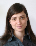
Karolin Kastowsky-Priglinger has studied prehistoric archaeology at the ![]() Institute for Pre-history and Early Medieval History at the
Institute for Pre-history and Early Medieval History at the ![]() University of Vienna. She was lucky to have her first excavation dug after the stratigraphic method and immediately got fascinated and convinced by this method as well as the possibilities of modern approaches of documentation and data capturing in archaeology. Her special focus lies within the field of 'GIS in Archaeology', 3D recording - 3D Laser Scanning, data processing and interpretation, field methods, application of different measurement techniques and there further processing as well as the possibilities of data visualization which she will focus on in her theses as well.
University of Vienna. She was lucky to have her first excavation dug after the stratigraphic method and immediately got fascinated and convinced by this method as well as the possibilities of modern approaches of documentation and data capturing in archaeology. Her special focus lies within the field of 'GIS in Archaeology', 3D recording - 3D Laser Scanning, data processing and interpretation, field methods, application of different measurement techniques and there further processing as well as the possibilities of data visualization which she will focus on in her theses as well.
She was early included into the team of Prof. Wolfgang Neubauer and was working within several projects as technical assistant as well as tutor at the University of Vienna. Karolin contributed within projects directed by the ![]() RGZM - Römisch Germanisches Zentralmuseum (China/Xi'an - Measurement of the Emperors Tombs of the Tang-Dynasty; Ukrain/Crimea/ Mangup - Early Medieval Settlements), the
RGZM - Römisch Germanisches Zentralmuseum (China/Xi'an - Measurement of the Emperors Tombs of the Tang-Dynasty; Ukrain/Crimea/ Mangup - Early Medieval Settlements), the ![]() ZAMG - Central Institute for Meteorology and Geodynamics (Carnuntum),
ZAMG - Central Institute for Meteorology and Geodynamics (Carnuntum), ![]() Riegl - Laser Measurement Systems (Egypt/Ghiza - 3D Laserscanning of the Sphinx, Cheops and Chephren Pyramid), and
Riegl - Laser Measurement Systems (Egypt/Ghiza - 3D Laserscanning of the Sphinx, Cheops and Chephren Pyramid), and ![]() VIAS - Vienna Institute for Archaeological Science (Austria/Leopoldsberg - Development of interdisciplinary gadgets for commercial usage; Sweden - 3D Laser Scanning at Nibbla and Birka; Bermuda - 3D Laser scanning of the Casemates). Besides her work as technical assistant concentrating on 3D Laser Scanning and geodetic survey she was able to gather a lot of experience in the field within various excavations as well as for geophysical surveying (GPR and CS-magnetometry) and interpretation.
VIAS - Vienna Institute for Archaeological Science (Austria/Leopoldsberg - Development of interdisciplinary gadgets for commercial usage; Sweden - 3D Laser Scanning at Nibbla and Birka; Bermuda - 3D Laser scanning of the Casemates). Besides her work as technical assistant concentrating on 3D Laser Scanning and geodetic survey she was able to gather a lot of experience in the field within various excavations as well as for geophysical surveying (GPR and CS-magnetometry) and interpretation.
She wrote her diploma theses about the GIS based documentation system within the prehistoric mountain site of Hallstatt/Austria, a project by the ![]() NHM - Vienna Natural History Museum.
NHM - Vienna Natural History Museum.
After two years in London/UK she started at the ![]() LBI ArchPro - Ludwig Boltzmann Institute for Archaeological Prospection and Virtual Archaeology in Vienna in April 2010. Her current main interests focus on GIS based visualization techniques for enhanced interpretation methods as well as new ways of visualization of archaeological prospection data for on-site usage.
LBI ArchPro - Ludwig Boltzmann Institute for Archaeological Prospection and Virtual Archaeology in Vienna in April 2010. Her current main interests focus on GIS based visualization techniques for enhanced interpretation methods as well as new ways of visualization of archaeological prospection data for on-site usage.
Mag. Katalin Tolnai
Research Topic : ![]() Modeling of the dynamic development of centre places related to the landscape.
Modeling of the dynamic development of centre places related to the landscape.
Katalin Tolnai has received an MA degree at the ![]() Eötvös Loránd University Budapest, Hungary in medieval archaeology and also in Inner Asian Studies. Her thesis in medieval archaeology focused on the archaeological aspects of a Late Roman fortification re-used as an early royal castle site in the Middle Ages. After graduating she has been accepted to the MA program in Medieval Studies at
Eötvös Loránd University Budapest, Hungary in medieval archaeology and also in Inner Asian Studies. Her thesis in medieval archaeology focused on the archaeological aspects of a Late Roman fortification re-used as an early royal castle site in the Middle Ages. After graduating she has been accepted to the MA program in Medieval Studies at ![]() Central European University Budapest, Hungary. Her thesis dealt with integration of data stemmed from various prospection methods and archaeological excavation data into one information system. This work was based on her studies in the field of medieval archaeology as well as her postgraduate studies in geoinformatics.
Central European University Budapest, Hungary. Her thesis dealt with integration of data stemmed from various prospection methods and archaeological excavation data into one information system. This work was based on her studies in the field of medieval archaeology as well as her postgraduate studies in geoinformatics.
After taking part in various field practices she had the possibility to take part in landscape archaeological projects outside from Hungary. As a team member she participated in a topographical survey on of archaeological sites in Cambodia and in 2011 in Ladakh, India. Since 2009 she works as a GIS expert at the ![]() Hungarian National Museum - Centre for National Cultural Heritage, where she coordinates the design and implementation of a complex archaeological GIS database.
Hungarian National Museum - Centre for National Cultural Heritage, where she coordinates the design and implementation of a complex archaeological GIS database.
Her main interest lies on the integration of the different types of data analyses which can result in the development of new strategies in spatio-temporal modeling. With the help of archeological raw material and chronologically ordered data her research will result in generating a model interpreting time, as a real coordinate.
Ing. Mag. Manuel Gabler
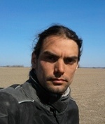
Research Topic : ![]() Landscape archaeological interpretation of combined prospection data from Uppåkra, Sweden
Landscape archaeological interpretation of combined prospection data from Uppåkra, Sweden
Manuel Gabler is a qualified archaeologist and electronic engineer. His studies were completed in August 2011 at the ![]() Institute for Pre-history and Early Medieval History at the
Institute for Pre-history and Early Medieval History at the ![]() University of Vienna. During his studies he achieved fundamental knowledge in archaeological prospection and interpretation by attending several courses at the University of Vienna. During his international placement at
University of Vienna. During his studies he achieved fundamental knowledge in archaeological prospection and interpretation by attending several courses at the University of Vienna. During his international placement at ![]() Trondheim / Norway emphasises was given to the Iron Age Period in Scandinavia. He has gained extensive practical experience in archaeological geophysical prospection during his work for the
Trondheim / Norway emphasises was given to the Iron Age Period in Scandinavia. He has gained extensive practical experience in archaeological geophysical prospection during his work for the ![]() Ludwig Boltzmann Institute (LBI) for Archaeological Prospection and Virtual Archaeology. In relation to this work he wrote his diploma thesis about the archaeological prospection of the Iron Age settlement in Uppåkra/South Sweden. His main research at the IC-ArchPro deals with new methods for archaeological interpretation for large scale geophysical prospection.
Ludwig Boltzmann Institute (LBI) for Archaeological Prospection and Virtual Archaeology. In relation to this work he wrote his diploma thesis about the archaeological prospection of the Iron Age settlement in Uppåkra/South Sweden. His main research at the IC-ArchPro deals with new methods for archaeological interpretation for large scale geophysical prospection.
Mag. Martin Fera
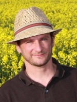
Martin Fera is a prehistoric archaeologist by training. The focus of his education at the ![]() Institute for Pre-history and Early Medieval History at the
Institute for Pre-history and Early Medieval History at the ![]() University of Vienna was on the archaeology of prehistoric and historic landscapes with the help of various archaeological prospection techniques. One of his interests is the spatiotemporal analysis of archaeological data with the help of GIS on different scales.
University of Vienna was on the archaeology of prehistoric and historic landscapes with the help of various archaeological prospection techniques. One of his interests is the spatiotemporal analysis of archaeological data with the help of GIS on different scales.
He gathered extended experience in the documentation of stratigraphic excavations during many interdisciplinary research projects with the ![]() Vienna Institute of Archaeological Science, where he was engaged as a site director.
Vienna Institute of Archaeological Science, where he was engaged as a site director.
His diploma thesis analysed a stratigraphic excavation of a Funnel Beaker site in Lower Austria, which was documented in a GIS-based documentation system.
During his participation in various research projects for the ![]() Aerial Archive of the University of Vienna and the
Aerial Archive of the University of Vienna and the ![]() Austrian Academy of Sciences, with emphasis on large scale remote sensing for past landscapes, he contributed to spatial analyses with the help of aerial archaeology and LIDAR-derived topographic data. Beside that he can refer to experience in geophysical surveying (GPR and CS-magnetometry) and interpretation.
Austrian Academy of Sciences, with emphasis on large scale remote sensing for past landscapes, he contributed to spatial analyses with the help of aerial archaeology and LIDAR-derived topographic data. Beside that he can refer to experience in geophysical surveying (GPR and CS-magnetometry) and interpretation.
The interest and technical skills in handling these tools (enhanced at an intensive course at the ![]() University of Ljubljana in 2005) and his field experience he had gathered in the cooperation with various regional research institutions in different regions all over Austria enable him to contribute to the development of tools for a deeper understanding of human activity and the history of landscapes in all it’s aspects.
University of Ljubljana in 2005) and his field experience he had gathered in the cooperation with various regional research institutions in different regions all over Austria enable him to contribute to the development of tools for a deeper understanding of human activity and the history of landscapes in all it’s aspects.
Mag. Michal Ruš
![]() Email
Email
Homepage : ![]() coni.sk
coni.sk
Full CV : ![]() bio.coni.sk
bio.coni.sk
Research Topic : ![]() Revealing the invisible: evaluation of modern remote sensing techniques in the light of archaeological prospection.
Revealing the invisible: evaluation of modern remote sensing techniques in the light of archaeological prospection.
Michal Ruš was a web developer long before he got his hands dirty with archaeology. He has 12 years of experience in commercial web projects.
During his studies of classical archaeology at the ![]() University of Trnava he immediately got interested in the use of IT in archaeology and tried to apply this approach whenever was possible. Besides web projects for the
University of Trnava he immediately got interested in the use of IT in archaeology and tried to apply this approach whenever was possible. Besides web projects for the ![]() Department of Classical Archaeology he applied for a grant for his project Quadrocopter. He was successful and made a few test photos using this miniUAV.
Department of Classical Archaeology he applied for a grant for his project Quadrocopter. He was successful and made a few test photos using this miniUAV.
His Master thesis was a combination of a frustration with low quality of input data and a battle with GIS non-friendly environment at the Department. However using a theme "Spatial analysis of finds from Germanic residence in Cífer-Pác" he was able to produce a number of spatial distribution maps based on a georectified raster layers.
His main research interests in this group include image pattern recognition and data fusion algorithms using ALS and AHS datasets. This approach has high potential for auto-classification of various archaeological features visible in open landscape from above e.g. cropmarks, soilmarks. Besides this main activity he has interest in UAV/Aerial Archaeology and other non-destructive prospection methods.
Mag. Petra Schneidhofer, MSc.
Research Topic : ![]() Investigating the potential of large scale, high resolution archaeological prospection data for palaeoenvironmental reconstruction.
Investigating the potential of large scale, high resolution archaeological prospection data for palaeoenvironmental reconstruction.
Petra Schneidhofer studied Pre- and Protohistory at the ![]() University of Vienna (AUT) and
University of Vienna (AUT) and ![]() University of Bradford (UK) and completed her diploma in 2010. During her studies she focused on field methods, 3D recording and visualisation techniques, GIS data analysis and interpretation within several projects directed by the
University of Bradford (UK) and completed her diploma in 2010. During her studies she focused on field methods, 3D recording and visualisation techniques, GIS data analysis and interpretation within several projects directed by the ![]() Vienna Institute of Archaeological Science (VIAS), the
Vienna Institute of Archaeological Science (VIAS), the ![]() Vienna Natural History Museum (NHM) and the
Vienna Natural History Museum (NHM) and the ![]() Austrian Federal Agency for the Preservation of Archaeological Monuments (BDA).
Austrian Federal Agency for the Preservation of Archaeological Monuments (BDA).
In 2011, she gained a ![]() NERC studentship to undertake a
NERC studentship to undertake a ![]() Master of Science programme in Geoarchaeology at the University of Reading (UK), which she successfully completed. Her research project concentrated on site formation processes in the prehistoric salt mine of Hallstatt using a multi-method approach that included micromorphology, XRF, XRD, grain size, pH and pollen analysis.
Master of Science programme in Geoarchaeology at the University of Reading (UK), which she successfully completed. Her research project concentrated on site formation processes in the prehistoric salt mine of Hallstatt using a multi-method approach that included micromorphology, XRF, XRD, grain size, pH and pollen analysis.
Her current research interests centre around the reconstruction of archaeological landscape entities based on palaeoenvironmental and prospection data.
Mag. Tomáš Tencer
Research Topic : ![]() Urban reflections in a landscape: evaluation of the urban spatial analysis in a light of the archaeological prospection.
Urban reflections in a landscape: evaluation of the urban spatial analysis in a light of the archaeological prospection.
Tomáš Tencer has studied archaeology at Masaryk University. In 2004 he joined the research team at archaeological site ![]() Pohansko near Breclav and starts working as GIS technician at Institute of Archaeology and Museology, Masaryk University. From the 2007 he has gained experience in a geophysical prospection and contributed on several projects from France to Syria. During his study and work his was focus and trained in spatial analysis, applications of digital methods (esp. GIS), archaeological modelling, geophysical prospection and interpretation as well as in archaeological excavation techniques.
Pohansko near Breclav and starts working as GIS technician at Institute of Archaeology and Museology, Masaryk University. From the 2007 he has gained experience in a geophysical prospection and contributed on several projects from France to Syria. During his study and work his was focus and trained in spatial analysis, applications of digital methods (esp. GIS), archaeological modelling, geophysical prospection and interpretation as well as in archaeological excavation techniques.
In his ![]() thesis, he investigates mutual spatial relations of archaeological components and their surroundings, through the series of prediction models. His current research interests centres around the application of spatial analysis in urban environment and landscape reconstruction. Space Syntax analysis (SSA), as a tool for revealing social behaviour indicated by space structures, offers a new level of cognition of the urban space. The configuration of the space in the city is not only in mutual relationship with anthropological activities within its boundaries, but also reacts and responds to the changes in the landscape that integrates the city as its part.
thesis, he investigates mutual spatial relations of archaeological components and their surroundings, through the series of prediction models. His current research interests centres around the application of spatial analysis in urban environment and landscape reconstruction. Space Syntax analysis (SSA), as a tool for revealing social behaviour indicated by space structures, offers a new level of cognition of the urban space. The configuration of the space in the city is not only in mutual relationship with anthropological activities within its boundaries, but also reacts and responds to the changes in the landscape that integrates the city as its part.
The behaviour of the urban landscape is influenced by natural, anthropogenic, and social-economic factors. These determine the formation of urban structures both directly and indirectly. Landscape, on the other hand, depends on numerous and different urban-economic and social complexes, which determine landscape properties.
In his research, he will investigate the above mentioned relationships through the results of fusion of archaeological prospection data and spatial and statistical analyses. Space Syntax research makes it possible to analyse different kinds of space patterns. By observing these structures, it possible to reveal hidden social activities embodied within each space, study internal layout of a city, spatial patterns, and relation between the groups of buildings, and compare these groups or buildings. Landscape and archaeological modelling will help us to analyse the relationship between the urban and landscape environments.
Mag. Willem Vletter
Research Topic : ![]() Reconstruction of prehistoric and historic road and path networks in vegetated areas through the application of Airborne Laser Scanning
Reconstruction of prehistoric and historic road and path networks in vegetated areas through the application of Airborne Laser Scanning
Work experience
Spatial planning consultant at ![]() Drents Plateau
Drents Plateau
As historical geographer managing and participating in cultural heritage projects. In these projects he used among others aerial photos, historical maps, soil data and LIDAR data (AHN) as information sources.
Employee at the ![]() Centro di geotecnologie of the
Centro di geotecnologie of the ![]() University of Siena, Italy.
University of Siena, Italy.
One of the main activities was measuring, via a total station, hydrological structures along creeks and rivers in the Tuscan mountains and describing their physical state in a GPS system.
Education
Master at the ![]() Centro di geotecnologie of the
Centro di geotecnologie of the ![]() University of Siena, Italy.
University of Siena, Italy.
Final part of master was a stage at the ![]() laboratory of landscape archaeology and remote sensing (LAP&T) in Grosseto (Italy). The research area was part of the coastal plain near Grosseto. During this stage he performed a preliminary archaeological research based on elaborated aerial photographs, satellite images, historical maps and soil data. A micro elevation model was obtained via GPS during the field survey. All data were represented in a GIS environment, in which also possible archaeological features and ancient river channels were drawn. The final result was the discovery of a new archaeological site, which has been interpreted as a medieval motte of around the 10th century after Christ.
laboratory of landscape archaeology and remote sensing (LAP&T) in Grosseto (Italy). The research area was part of the coastal plain near Grosseto. During this stage he performed a preliminary archaeological research based on elaborated aerial photographs, satellite images, historical maps and soil data. A micro elevation model was obtained via GPS during the field survey. All data were represented in a GIS environment, in which also possible archaeological features and ancient river channels were drawn. The final result was the discovery of a new archaeological site, which has been interpreted as a medieval motte of around the 10th century after Christ.
History at the ![]() University of Leiden.
University of Leiden.
Thesis: historic-geographical research on the history of settlement dispersion in relation to environmental conditions in the highland of ![]() Valle d’Itria in Puglia (Italy) as part of the archaeological Salento Isthmus project of the
Valle d’Itria in Puglia (Italy) as part of the archaeological Salento Isthmus project of the ![]() Free University of Amsterdam, the
Free University of Amsterdam, the ![]() University of Lecce and the archaeological board of the region Puglia.
University of Lecce and the archaeological board of the region Puglia.
One of the founders of ![]() DECARS (Dutch Expertise Centre for Archaeological Remote Sensing).
DECARS (Dutch Expertise Centre for Archaeological Remote Sensing).
Universität Wien
co Vienna Institute for Archaeological Science
Franz-Klein-Gasse 1/III
A-1190 Wien
T: +43-1-4277-40304


