Associated Fellows / PhD students
MSc. Agata Klimczyk
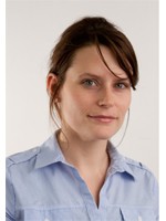
Agata Klimczyk has graduated from the Warsaw University of Technology in 2009 as the Master of Science in Geodesy and Cartography. Her diploma thesis concerned creating photogrammetric documentation for archaeological sites.
She has been connected with archaeology in Vienna for two years - Agata has attended the Erasmus Program at ![]() Vienna University of Technology, Leonardo da Vinci Internship Program at
Vienna University of Technology, Leonardo da Vinci Internship Program at ![]() University of Vienna and currently she is an employee of
University of Vienna and currently she is an employee of ![]() LBI. Her main responsibilities there are: creating orthophotomaps, mosaics, digital terrain models, and analysis of Airborne Laser Scanning data.
LBI. Her main responsibilities there are: creating orthophotomaps, mosaics, digital terrain models, and analysis of Airborne Laser Scanning data.
Additionally she is studying further at the Vienna University of Technology. She also leads guest lectures concerning the basics of photogrammetry at the ![]() Institute of Archaeology, Warsaw University, with which she has been cooperating since 2008 –
Institute of Archaeology, Warsaw University, with which she has been cooperating since 2008 – ![]() Mission Ptolemais.
Mission Ptolemais.
Her scientific interests lie in the field of practical usage of photogrammetry and remote sensing in archaeology.
M.A. Christine Markussen
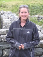
Research Topic : ![]() Stratigraphic Analysis and Interpretation of 3D Ground Penetrating Radar Data
Stratigraphic Analysis and Interpretation of 3D Ground Penetrating Radar Data
Christine Markussen is the GIS/Geospatial Program Manager at ![]() EnviroSystems Management, Inc. in Flagstaff, Arizona. She received her Master's degree at the
EnviroSystems Management, Inc. in Flagstaff, Arizona. She received her Master's degree at the ![]() University of Arkansas where she focused on archaeological prospection methods and techniques along with raster GIS analysis. During this time she applied her web development skills by working on the
University of Arkansas where she focused on archaeological prospection methods and techniques along with raster GIS analysis. During this time she applied her web development skills by working on the ![]() North American Database of Archaeological Geophysics (NADAG) with Dr. Ken Kvamme. She had a Research Assistantship (RA) cataloging geophysical data for archaeological sites in North Dakota. Her Master's thesis involved analysis of archaeological feature signals and shapes, their spatial relationships, and characteristics on the
North American Database of Archaeological Geophysics (NADAG) with Dr. Ken Kvamme. She had a Research Assistantship (RA) cataloging geophysical data for archaeological sites in North Dakota. Her Master's thesis involved analysis of archaeological feature signals and shapes, their spatial relationships, and characteristics on the ![]() Double Ditch site in North Dakota. Microtopography of the present landscape was also analyzed to identify the spatial relations to prehistoric features across the site.
Double Ditch site in North Dakota. Microtopography of the present landscape was also analyzed to identify the spatial relations to prehistoric features across the site.
She has been involved in numerous archaeological prospection projects throughout the United States (New Mexico, Arkansas, Oklahoma, North Dakota, Kansas, and Arizona). Her interests in archaeological prospection, geodetics, and computer applications in archaeology has also permitted her to travel abroad for various research projects and often provide insight into data processing and interpretation of geophysical anomalies on archaeological sites. She has participated in archaeological prospection projects in Romania, Turkey (![]() Kerkenes), the United Arab Emirates, and Wales.
Kerkenes), the United Arab Emirates, and Wales.
Current Research/Projects
She is also currently involved in other international projects including multi-sensor data integration and 3-D data visualization for an Iron Age Hillfort in Northern Wales, and identifying prehistoric agricultural practices through combined soil analysis and magnetic susceptibility measurements in the Atacama Desert of Northern Chile. Christine is currently a Digital Fellow at the ![]() Center for Advanced Spatial Technologies (CAST) at the Univeristy of Arkansas. Christine is currently collaborating with CAST on 3-D scanning projects in the southwest United States. These efforts aim to identify the utility of high resolution 3-D imaging as a practical method of documentation for baseline preservation efforts of damaged and threatened architecture on archaeological sites as well as thorough cost-benefit analyses compared to traditional documentation. In addition, she is involved in beta testing of CAST's geophysical software
Center for Advanced Spatial Technologies (CAST) at the Univeristy of Arkansas. Christine is currently collaborating with CAST on 3-D scanning projects in the southwest United States. These efforts aim to identify the utility of high resolution 3-D imaging as a practical method of documentation for baseline preservation efforts of damaged and threatened architecture on archaeological sites as well as thorough cost-benefit analyses compared to traditional documentation. In addition, she is involved in beta testing of CAST's geophysical software ![]() Archaeofusion and is pursuing opportunities for future updates to and maintainence of the
Archaeofusion and is pursuing opportunities for future updates to and maintainence of the ![]() NADAG site.
NADAG site.
While at the University of Vienna Christine plans on developing her skills in both GIS and archaeological prospection by integrating geophysical data processing into a GIS environment through source code and scripting. She will use a high resolution data set form the case study Flavia Solva, A Roman town in Austria, to transfer GPR visualization and Interpretation tools into GIS.
Mag. David Ruß
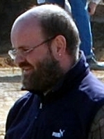
Research Topic : Magnetic Ports of Trade - Landscape archaeological interpretation of large scale geophysical prospection at Viking Age Central Places (Hedeby, Birka, Kaupang)
David Ruß holds a Master’s degree from the ![]() Department for Prehistoric and Early Historic Archaeology, University of Vienna. His main archaeological expertise lies in the areas of prospection, excavation and archaeological heritage management. He was involved in prospection activities and excavations in Germany (Haithabu) and Austria (Hallstatt graveyard and saltmine, Schwarzenbach, Gars/Thunau, Kamegg, Oberleiserberg) and engaged in several experimental archaeology projects. In his Master’s thesis he presented the research results of the investigation of early Carolingian burial sites in the Steyr and Enns vallies.
Department for Prehistoric and Early Historic Archaeology, University of Vienna. His main archaeological expertise lies in the areas of prospection, excavation and archaeological heritage management. He was involved in prospection activities and excavations in Germany (Haithabu) and Austria (Hallstatt graveyard and saltmine, Schwarzenbach, Gars/Thunau, Kamegg, Oberleiserberg) and engaged in several experimental archaeology projects. In his Master’s thesis he presented the research results of the investigation of early Carolingian burial sites in the Steyr and Enns vallies.
David Ruß is Head of the Archaeology Department at ![]() ASINOE, a non-profit employment programme which promotes archaeological research and reintegrates long term unemployed people into the labour market. In addition, he is in charge of ASINOE’s quality management, database management, GIS and statistics.
ASINOE, a non-profit employment programme which promotes archaeological research and reintegrates long term unemployed people into the labour market. In addition, he is in charge of ASINOE’s quality management, database management, GIS and statistics.
Joining the IC-ArchPro provides him with the exciting opportunity to engage in landscape archaeology and spatial analysis of early Viking Age Central Places.
M.A. Eamonn Baldwin

Research Topic : ![]() The anatomy of round barrows within the Stonehenge landscape: A case study in fusing archaeological prospection data with high resolution terrain models.
The anatomy of round barrows within the Stonehenge landscape: A case study in fusing archaeological prospection data with high resolution terrain models.
Eamonn is responsible for the ![]() VISTA Centre's Remote Sensing division at the University of Birmingham. He has extensive experience in the archaeological application of geomatics in both research and commercial environments. In particular, he specialises in a range of archaeological survey methods, which include geophysical survey, topographical survey and standing building recording and appraisal, as well as in the integration and management of spatial data in GIS and CAD systems for analytical purposes or heritage management. His research interests lie in the investigation, interpretation and presentation of archaeological landscapes through remote sensing technologies. He is also Member of the Scientific Board and Senior Researcher of the
VISTA Centre's Remote Sensing division at the University of Birmingham. He has extensive experience in the archaeological application of geomatics in both research and commercial environments. In particular, he specialises in a range of archaeological survey methods, which include geophysical survey, topographical survey and standing building recording and appraisal, as well as in the integration and management of spatial data in GIS and CAD systems for analytical purposes or heritage management. His research interests lie in the investigation, interpretation and presentation of archaeological landscapes through remote sensing technologies. He is also Member of the Scientific Board and Senior Researcher of the ![]() LBI ArchPro. He received MAs in
LBI ArchPro. He received MAs in ![]() Classical Studies from the University of Dublin in 1998 and in Landscape Archaeology and Geomatics from the
Classical Studies from the University of Dublin in 1998 and in Landscape Archaeology and Geomatics from the ![]() Institute of Archaeology and Antiquity, Birmingham in 2002.
Institute of Archaeology and Antiquity, Birmingham in 2002.
M.A. Joris Coolen
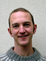
Research Topic : ![]() Reconstructing prehistoric land-use on the basis of integrated surface surveying.
Reconstructing prehistoric land-use on the basis of integrated surface surveying.
Joris Coolen (Eindhoven, NL, 1981) studied prehistoric and historical archaeology at the University of Vienna, where he got a profound introduction to archaeological prospection methods and GIS. During his studies he participated in various rescue and research excavations in Austria (including Hallstatt, Schwarzenbach), France (Bibracte, Gergovia), Germany (Xanten) and the Netherlands, covering a wide range of archaeological sites from a late-Palaeolithic hunter-gatherer camp to a 19th C soap manufactory. From 2007 to 2010, he worked for the Austrian Archaeological Institute, where he got practical experience in geophysical prospection, field surveying and GIS-based spatial analysis, taking part in various survey projects and small excavations in Austria, Hungary, Turkey and Slovenia. Among other things, he participated in the Mautern Hinterland Survey, a large-scale survey project focussing on Roman settlement in the hinterland of the Danubian limes between Pöchlarn, Traismauer and St. Pölten in Lower Austria. This project increased his interest in ploughsoil archaeology and the spatial patterning of archaeological remains throughout the landscape.
In his MA-thesis on the early-Neolithic (Linearbandkeramik) settlement geography in the area of Melk in Lower Austria, he combined traditional artefact-studies of finds made by local amateur-archaeologists with systematically collected field survey data, partly from the Mautern Hinterland Project, and used these data to test a predictive model of early-Neolithic settlement finds.
Since 2010, Joris has been taking part in The Assembly Project – ‘Meeting Places in Northern Europe AD 400-1500’, for which he carried out geomagnetic surveys on various assumed medieval assembly sites in Shetland, and recently co-directed an excavation in Tingwall, Shetland.
Mag. Mario Wallner
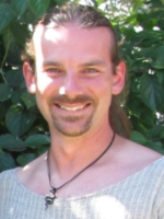
Research Topic : ![]() A spatial analysis of the western "suburbs" of the Roman civil town Carnuntum on the basis of a integrated interpretation of geophysical prospections.
A spatial analysis of the western "suburbs" of the Roman civil town Carnuntum on the basis of a integrated interpretation of geophysical prospections.
Mario Wallner has graduated at the ![]() University of Vienna in Celtic Studies with combined subjects on Prehistoric Archaeology, Geophysical Prospection and Remote Sensing. During his studies he participated in excavations in Austria and North Wales ('Early Celtic Societies in North Wales'-project from the University of Bangor). Since 2011 he achieved fundamental knowledge in archaeological prospection and interpretation during his fieldwork for the
University of Vienna in Celtic Studies with combined subjects on Prehistoric Archaeology, Geophysical Prospection and Remote Sensing. During his studies he participated in excavations in Austria and North Wales ('Early Celtic Societies in North Wales'-project from the University of Bangor). Since 2011 he achieved fundamental knowledge in archaeological prospection and interpretation during his fieldwork for the ![]() Ludwig Boltzmann Institute (LBI) for Archaeological Prospection and Virtual Archaeology. His current research interests are focused on the integrated interpretation of the different archaeological prospetion methods.
Ludwig Boltzmann Institute (LBI) for Archaeological Prospection and Virtual Archaeology. His current research interests are focused on the integrated interpretation of the different archaeological prospetion methods.
Mag. Ulrike Fornwagner
Research Topic : ![]() Integrated archaeological interpretation of remote sensing and geophysical prospection data of the Case Study area Zillingdorf.
Integrated archaeological interpretation of remote sensing and geophysical prospection data of the Case Study area Zillingdorf.
Ulrike Fornwagner studied Classical Archaeology and combined studies (Prehistoric and Medieval Archaeology, Ancient History and English and American Studies) at the ![]() University of Vienna. During her studies she took part in excavations and extensive surveys in Austria and Greece. From 1992-2001 she participated in geomagnetic and resistivity surveys at Roman sites such as Carnuntum or Flavia Solva and of Neolithic circular ditch systems in Lower Austria. Since 2003 she has been involved in projects on airborne remote sensing at the
University of Vienna. During her studies she took part in excavations and extensive surveys in Austria and Greece. From 1992-2001 she participated in geomagnetic and resistivity surveys at Roman sites such as Carnuntum or Flavia Solva and of Neolithic circular ditch systems in Lower Austria. Since 2003 she has been involved in projects on airborne remote sensing at the ![]() Department of Prehistoric and Medieval Archaeology and the
Department of Prehistoric and Medieval Archaeology and the ![]() Austrian Academy of Sciences, where she focussed on aerial archaeological interpretation of different landscapes in Austria. She attended an intensive course on remote sensing for past landscapes (RESPAL,
Austrian Academy of Sciences, where she focussed on aerial archaeological interpretation of different landscapes in Austria. She attended an intensive course on remote sensing for past landscapes (RESPAL, ![]() University of Ljubljana) in 2006. Her current research interests focus on the methodological development for integrated archaeological remote sensing.
University of Ljubljana) in 2006. Her current research interests focus on the methodological development for integrated archaeological remote sensing.
Dott.ssa Valeria Poscetti
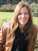
Valeria Poscetti studied Classical Archaeology at ![]() University of Rome “La Sapienza” and received her Master’s Degree with first class honours in 2003, defending a thesis focusing on geophysical methods applied to archaeology. During her studies she focused on the topic of the ancient topography as well as technical analysis of ancient buildings, and participated at several archaeological surveys in Italy (Ostia, Veio) and in France (excavations of the Gallo-Roman site of Vieux - Normandie). Since 2001 she has been involved in the field of archaeological geophysical prospection, collaborating with the Geophysical Department (Faculty of Engineering - University of Rome “La Sapienza”) and reaching theoretical and practical knowledge on the acquisition, processing and interpretation of geophysical data, mainly regarding the application of Ground Penetrating Radar.
University of Rome “La Sapienza” and received her Master’s Degree with first class honours in 2003, defending a thesis focusing on geophysical methods applied to archaeology. During her studies she focused on the topic of the ancient topography as well as technical analysis of ancient buildings, and participated at several archaeological surveys in Italy (Ostia, Veio) and in France (excavations of the Gallo-Roman site of Vieux - Normandie). Since 2001 she has been involved in the field of archaeological geophysical prospection, collaborating with the Geophysical Department (Faculty of Engineering - University of Rome “La Sapienza”) and reaching theoretical and practical knowledge on the acquisition, processing and interpretation of geophysical data, mainly regarding the application of Ground Penetrating Radar.
Before joining the team of Prof. Neubauer in Vienna (Autumn 2008), she collaborated in several interdisciplinary projects in Italy (such as “![]() Missione Archeologica a Mozia”) led by the University of Rome “La Sapienza” (Archaeological Department, Geophysical Department and Information and Communication Department), conducting archaeological geophysical surveys focused on the integration and comparison of geophysical data and excavation data, as well as on the reconstruction of ancient landscape. In the year 2007 she worked at the
Missione Archeologica a Mozia”) led by the University of Rome “La Sapienza” (Archaeological Department, Geophysical Department and Information and Communication Department), conducting archaeological geophysical surveys focused on the integration and comparison of geophysical data and excavation data, as well as on the reconstruction of ancient landscape. In the year 2007 she worked at the ![]() CISTEC (Research Centre of Science and Technology for the Conservation of Cultural Heritage – University of Rome “La Sapienza” - Faculty of Engineering) and led guest lectures on archaeological geophysical prospection at the same University (Archaeological Department).
CISTEC (Research Centre of Science and Technology for the Conservation of Cultural Heritage – University of Rome “La Sapienza” - Faculty of Engineering) and led guest lectures on archaeological geophysical prospection at the same University (Archaeological Department).
In 2008 she collaborated with the ![]() VIAS (Vienna Institute of Archaeological Science) as well as
VIAS (Vienna Institute of Archaeological Science) as well as ![]() Archeo Prospections team (ZAMG), improving her knowledge in the field of interpretation of geophysical data by using GIS software.
Archeo Prospections team (ZAMG), improving her knowledge in the field of interpretation of geophysical data by using GIS software.
In 2009 she started her doctoral program at University of Vienna (![]() Institute for Pre-history and Early Medieval History) working on the thesis “Archaeological Interpretation of GPR data”. She collaborates with the
Institute for Pre-history and Early Medieval History) working on the thesis “Archaeological Interpretation of GPR data”. She collaborates with the ![]() Ludwig Boltzmann Institute for Archaeological Prospection and Virtual Archaeology working on the archaeological interpretation of GPR data.
Ludwig Boltzmann Institute for Archaeological Prospection and Virtual Archaeology working on the archaeological interpretation of GPR data.
Her current research interests are focused on the application of Ground Penetrating Radar over large areas (multi-channel and multi-frequency antenna systems) and on the 3D archaeological interpretation of the data.
Ing. Mag. Viktor Jansa
Research Topic : ?
Viktor Jansa studied ![]() Pre- and Early History at the University of Vienna. In his „former“ life he was a building engineer and the responsible project manager for the completition of a considerable number of buildings. Due to his qualification and his professional practice he has advanced skills in engineering and project management. Beyond that he is an experienced diver and underwater photographer for nearly 20 years, what led to his special interest in underwater archaeology. Over the course of his diploma thesis he developed a workflow for the application of structure from motion on the monitoring of underwater archaeological sites in fresh water (both fieldwork/data aquisition and data processing) by the example of the UNESCO-world heritage „Pile Dwellings around the Alps“. For this project he used exclusively free linux-based software. In the context of his dissertation he works about the combined application of different methods for large-scale and high resolution underwater archaeological prospection.
Pre- and Early History at the University of Vienna. In his „former“ life he was a building engineer and the responsible project manager for the completition of a considerable number of buildings. Due to his qualification and his professional practice he has advanced skills in engineering and project management. Beyond that he is an experienced diver and underwater photographer for nearly 20 years, what led to his special interest in underwater archaeology. Over the course of his diploma thesis he developed a workflow for the application of structure from motion on the monitoring of underwater archaeological sites in fresh water (both fieldwork/data aquisition and data processing) by the example of the UNESCO-world heritage „Pile Dwellings around the Alps“. For this project he used exclusively free linux-based software. In the context of his dissertation he works about the combined application of different methods for large-scale and high resolution underwater archaeological prospection.
Viktor Jansa is also member of the ![]() LBI ArchPro Team in the programme line Archaeological Geophysical Prospection and field director for the Ground Penetrating Radar measurements in the Roman Town of Carnuntum.
LBI ArchPro Team in the programme line Archaeological Geophysical Prospection and field director for the Ground Penetrating Radar measurements in the Roman Town of Carnuntum.
Universität Wien
co Vienna Institute for Archaeological Science
Franz-Klein-Gasse 1/III
A-1190 Wien
T: +43-1-4277-40304


